OGC Standards
Open Geospatial Consortium (OGC) is a standards consortium of the geoprocessing industry, originated in 1994 with membership for companies, government agencies and universities. OGC develops open standards for geospatial data processing and sharing, which may be interchangeably branded as OGC® or OpenGIS®.
Hierarchy of OGC standards and supporting documents:
- OGC Reference Model (ORM) describes the conceptual framework of OGC Standards Baseline.
- OGC Standards Baseline
- Abstract Specification formally documents terms, information models, and software behaviors.
- Implementation Specifications detail the interface structure between software components.
- Data encodings are listed in the official OGC Schema Repository.
- Best Practices documents
- Other documents: Engineering Reports, Discussion Papers, White Papers, Change Requests
Service Framework
OGC standards deal with communicating geospatial data on the Web and other distributed computing platforms (e.g. CORBA and SQL). OGC Web Services (OWS) refers to OGC standards for Web-based geoprocessing, including most OGC standards.
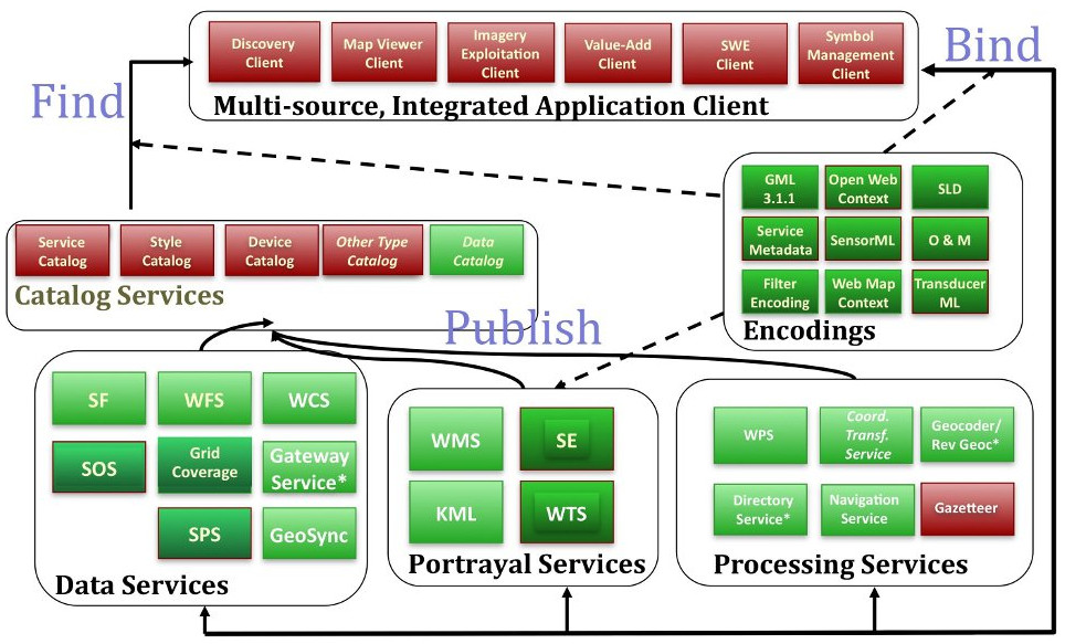
Key functions of Web services:
- Publish: Providers advertise their resources.
- Find: End users discover resources they need at run-time.
- Bind: End users access and exercise resources at run-time.
Service categories and selected standards: (ISO 19119)
- Encodings:
- Geography Markup Language (GML; ISO 19136) and its profiles and application schemas
- Filter Encoding (FE; ISO 19143)
- Observations and Measurements (O&M; ISO 19156)
- Web Map Context (WMC)
- Style Layer Descriptor (SLD)
- GeoRSS
- KML (formerly Keyhole Markup Language)
- NetCDF (Network Common Data Format)
- Data Services
- Simple Features (SF; ISO 19125)
- Web Feature Service (WFS; ISO 19142)
- Web Coverage Service (WCS)
- Processing Services
- Web Processing Service (WPS)
- Web Coverage Processing Service
- Coordinate Transformation Services
- OpenSearch Geo
- Portrayal Services
- Web Map Service (WMS; ISO 19128)
- Web Map Tile Service (WMTS)
- Web Terrain Service (WTS)
- Catalogue Service for the Web (CSW; ISO 19115)
Data Services
Simple Features, officially Simple Feature Access, specifies a common storage and access model of mostly two-dimensional geographical data. Simple Features has implementation in Well-Know Text, Well-Know Binary, SQL, GeoJSON, and others.
The OGC Feature hierarchy of classes:
- Feature Collection
- Feature
- Coverage: Earth Imagery (ISO 19101-2)
- Geometry
- Geolocation (Point)
- Spatial Referencing by Coordinates (Geodesy)
- Locational Geometry Structures (relative)
- Linear referencing (1D object)

Portrayal Services
Decomposition of data portrayal process:
- Query/filter data source: features (GML);
- Generate display elements: raster/vector style descriptions (SVG, WebCGM);
- Render image (GIF, JPEG, PNG, TIFF);
- Display on device (screen, printer, projector);