Transit Analysis
Routing on OpenStreetMap
Routing services using OpenStreetMap data
RealReach™ algorithm in skobbler/Scout
He [OSM founder Steve Coast] admitted that OSM falls short in two areas: navigation information like one-way streets and restricted turns, and geo-coded address data. To fix the navigation data issue, a team of about 25 people at Telenav has been looking at the GPS traces the company received from Scout users over the last three years and analyzed it. This has helped the company to determine what the likely speed limits in many areas are, for example, and if all cars just travel in a single direction on a given street or just make right turns, chances are this is indeed a one-way street or a restricted turn. (http://techcrunch.com/2014/05/19/telenav-takes-on-google-with-new-openstreetmap-based-offline-navigation-sdk/)
OpenTripPlanner
OpenTripPlanner (OTP) is an open source multi-modal trip planner. It depends on open data in open standard file formats (GTFS and OpenStreetMap), and includes a REST API for journey planning as well as a map-based Javascript client. OpenTripPlanner can also create travel time contour visualizations and compute accessibility indicators for planning and research applications. (related: TriMet, OpenPlans, Conveyal, Software Freedom Conservancy, David Emory, Brian Ferris, Brandon Martin-Anderson)
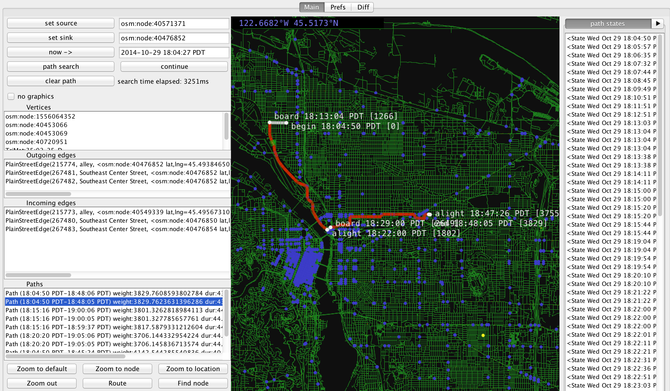
Figure: OpenTripPlanner's Graph Visualizer (in debugger with option --visualize)
Other Transit Analysis Software
TransitShed, also developed by Brandon Martin-Anderson. Announced on Transit Developer - Google Groups Currently unaccessible.
![]()
Figure: TransitShed Snapshot